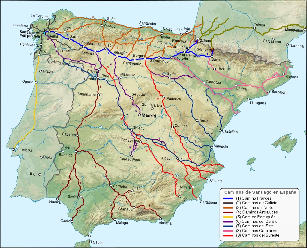
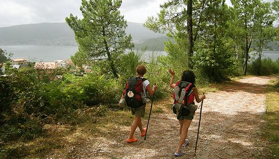
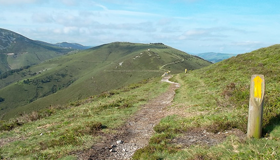
Camino Francés (French way)
This is the most common route of all the different routes of Camino de Santiago for hikers to take. More than 60% of all the pilgrims choose this way to walk. It crosses through Northern Spain starting at St. Jean Pied de Port or Ronchesvalles. This path has the most number of accommodations to stay at. The entire path is well signed with yellow arrow markers and the distances between each major town is a reasonable amount to cover for one day, which is why this is the most popular of the hikes.
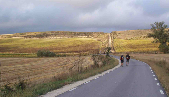
Assuming you start at St. Jean Pied de Port, the path is approximately 790km and takes you to Ronchesvalles, Pamplona, Burgos, Leon, Sarria, finishing at Santiago de Compostela. If you walk at a rate of 25km per day, the path should take 32 days.
Camino Francés starts with a hard first stage, 20 kms up to the pike of Pyranees Mountains, then 5 kms downhill to Roncesvalles. Once you pass the Pyranees Mountains, the second part of the path until Burgos should be better with a few hills and short mountain ranges along the way. After Burgos follows the completely flat plateau called Meseta until Astorga. This part of the Camino is good for meditation or speed-up if you want to save time. After Astorga mountains come again. To walk up to Cruz de Ferro and later to O’Cebreiro need much effort. The last part of the Camino is Galicia with smaller long hills until Santiago. After Sarria much more pilgrims walk along the way because of Sarria is the closest you can start to ensure that your camino passport gets all the required stamps to get your Compostela.
The weather along the route varies quite a lot, yet is still passable most of the year. There is a tendency for heavy rains Around Navarra and Galicia throughout the year at unexpected times. As well, it snows during the winter in the Pyranees and at the mountain ranges around Burgos and Leon during the winter. The summer months make the flat region between Burgos and Leon very difficult to pass through, as there is limited amount of shading in that region. The recommended time to do this hike would be in the spring and in autumn.
Camino Portugés (Portuguese way)
The second most popular way of the Camino de Santiago. About 20% of the pilgrims choose the Camino Portugés to walk. The starting city in this path is Lisbon, which overlooks the Atlantic Ocean and is the Capital of Portugal. The path continues north directly towards Oporto (which is also a popular starting point of Camino Portugés) and on to Santiago de Compostella. The walk consists of 503 kms through Portugal and 110km through Spain for a total of 613 kms. This should take approximately 24 days (9 days from Oporto) to hike.
Despite being less popular than the Camino Frances, the path is lined with yellow arrows all along the way. There are also blue arrows after Oporto, which point back to the Cathedral at Porto should you wish to trek in that direction. As well, accommodations are abundant all throughout the path.
The landscape of the path consists of many pine and eucalyptus forests and for the most part stays clear of major roads or highways. Due to its proximity to the Atlantic Ocean, there is often a high chance of rain along the route at anytime of year. The best time to hike this path is during the spring and autumn months since the weather is cool. Summer is often considered too hot despite the Atlantic Ocean breeze.
Vía de la Plata (Silver way)
This is the longest of all the different routes of Camino de Santiago in Spain. It goes from Sevilla in the south to Astorga in the north and from there to Santiago De Compostela. An alternative path called Camino Sanabrés branches off south of Astorga at Granja De Moreruela and goes via Ourense. The Vía De La Plata is 1000kms long (from Sevilla to Santiago) and takes about 37 days to walk without a rest day!
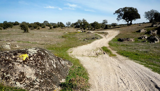
Undulating and not very difficult walking as far as Zamora although some of the distances between settlements are very long. Large sections of this route are more or less the same as they were two thousand years ago. After Zamora all of the variants to the Camino francés or directly to Santiago have many steep climbs and descents.
This is a more difficult path to take since southern Spain is hotter, which makes it difficult for most hikers who come during May to August.The best time to do hike this path is during the spring and autumn. Only the 3% of the pilgrims choose the Vía de la Plata to hike.
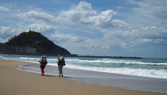
Camino del Norte (Northern way)
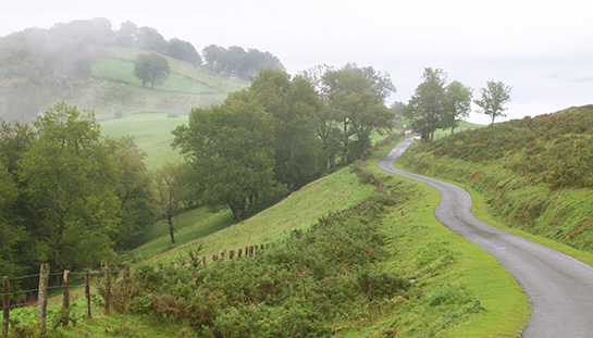
830 km from Irun to Santiago de Compostela and takes about 32 days to walk. Starting in Irun on the French-Spanish border and traveling through San Sebastían/Donostia, Bilbao, Santander, Gijón, Ribadeo (where it turns southwest away from the coast) and Mondonedo to Arzúa where it joins the Camino francés. Being near the coast, it is also a much cooler hike, which helps during the summer months as the heat can make the hike very challenging by midday.
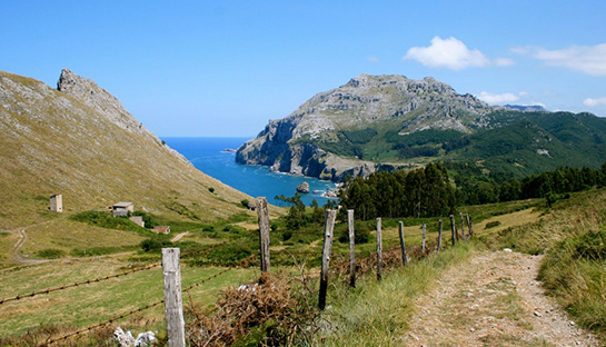
The Camino del Norte has many ascents and descents as it crosses the rivers that drain northward toward the northern Spanish coast. All of this makes the del Norte more difficult than one might expect. Although there are often impressive views of the sea, in many places the route is not within sight of the water. Because of the high number of turists on the coast, the first part of the Camino del Norte is noisy in summer season. But the portion of the Camino del Norte in Galicia is very tranquil.
There are not many albergues in the eastern stages of the route although there are more in the western parts of the route. Galicia is well-provided in this respect. Waymarked with yellow arrows although sketchy in places. About 6% of the pilgrims walking on the Camino del Norte.
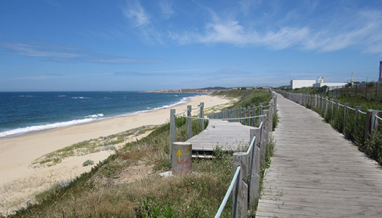
Camino Finisterre
Not many people know of this path since all paths lead to Santiago de Compostela. This path is intended for hikers who wish to walk to Finisterre (“End of Land”), which overlooks the Atlantic Ocean. It is quite pleasant to some because there are much fewer hikers who choose to do this optional path after finishing at Santiago de Compostela. To those few it is considered the true end of the Camino. Finisterre is famous for its beaches that have perfect horizon sunsets as well as the Lighthouse, which is a short afternoon hike from the city.
The path starts from Santiago and continues through a mountainous region past Cée, Corcubion and on towards Finisterre. Most hikers take 3 to 4 days to complete this path as Finisterre is only 90km away from Santiago de Compostella. Accommodations are abundant and available all along this hike. The path contains many hills and can get tiring. Fortunately it is covered with many trees providing lots of shade during the summer months. It is relatively pleasant to walk anytime during the year, as the weather is not that variable in this region.
Camino Aragonés
The dramatic and beautiful Camino Aragonés begins in the Pyrenees Mountains at Somport (1600 meters of altitude) and terminates just east of Puente la Reina, where it joins the Camino francés. 164 km from Somport through Jaca to Puente la Reina and takes about 6 days to walk. These 6 days are a journey back to the medieval times with walking on ancient roads and bridges.
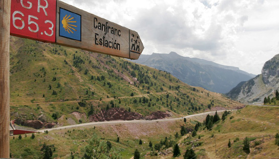
Very well marked with painted yellow arrows and symbols of modern shell. The aragonés is well populated with albergues as well as hotels, hostales and casas rurales.
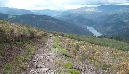
Camino Primitivo
The most beautiful Camino from all the differnet routes which lead to Sangiago. The Camino Primitivo (also known the Interior route) starts from Oviedo (near to Camino del Norte) and goes via Lugo before joining the Caminon Francés at Melide. The whole route is 375 kms from Oviedo to Santiago de Compostela which means about 14 days walking.
This is a difficult route as it passes over the western end of the Cordillera Cantábrica with a number of ascents and descents of 6 to 8%. If you are lucky enough to get good weather, you will be amply rewarded by the views. You need to be prepared, even in summer, for heavy rain and cold.
There are a number of pilgrim albergues along the route as well as some hostales and pensiones. Waymarking is variable although it is reported to be extremely good from Oviedo to the Galician border which is about half the route. About 4% of the pilgrims choose the Camino Primitivo to hike.


